
The Flatirons Adventure

The Flatirons
Adventure
Single:$420
2 CLIMBERS: $300 /PERSON
Intro - Advanced

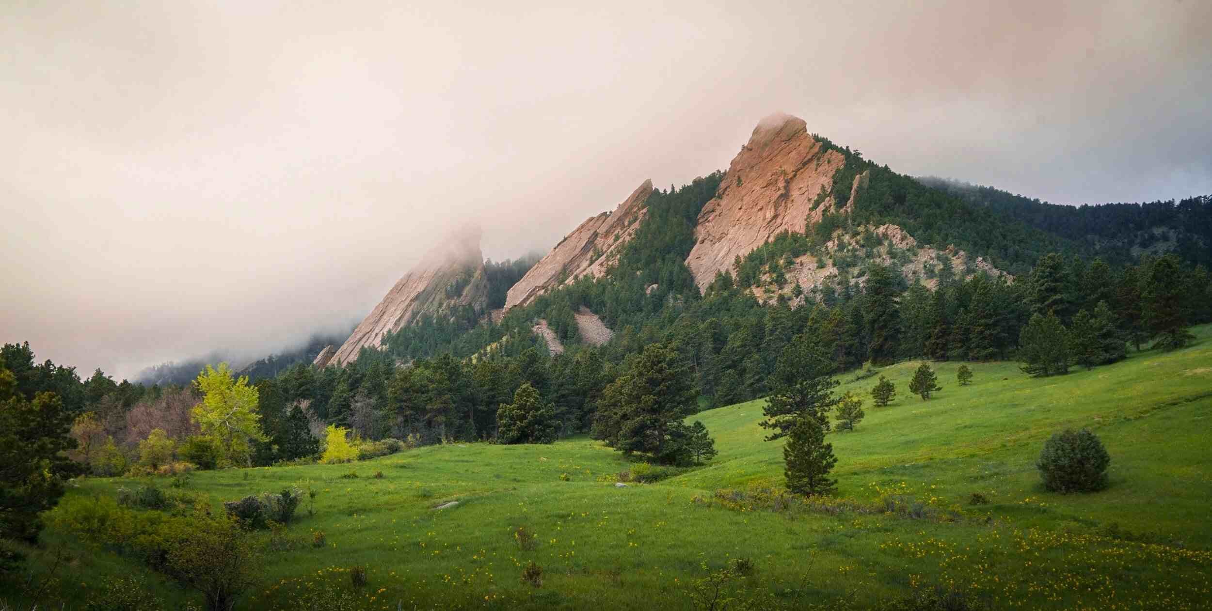
Chautauqua State Park, Boulder, Colorado

1-Day

The Flatirons flank Boulder, Colorado, and have a long history within its community. With a variety of climbing for all difficulty levels, great views, and high-quality rock, you’re always in for an inspiring day out!
This experience allows guests the opportunity to summit iconic Flatirons, such as the First, Second, or Third Flatiron; offering around a 1000 ft of climbing adventure!

-
The Flatirons flank Boulder, Colorado, and have a long history within its community. With a variety of climbing for all difficulty levels, great views, and high-quality rock, you’re always in for an inspiring day out!
This experience allows guests the opportunity to summit iconic Flatirons, such as the First, Second, or Third Flatiron; offering around a 1000 ft of climbing adventure!
Most climbs take between 4-6 hours, but allow about 8 hours of your day for this climb, beginning orientation and hiking to the base.
Common Routes Include:
-
This adventure takes place in Chautauqua State Park in Boulder, Colorado.
Pre-Adventure Trip Call:
Our team extends the offer to schedule a call before your guided tour. They will discuss route options for the day, review gear needs, and share a general time plan for the trip. This is also a great way to ask any questions about the day!
Morning:
Meet at the Rangers Cottage at Chautauqua and share a quick morning hello, and the day’s itinerary. The team will make any small adjustments to the kit and then take a stroll to our climb.
An integral part of climbing is familiarity with the area and its history. Our team shares some stories and educates as we approach the climb.
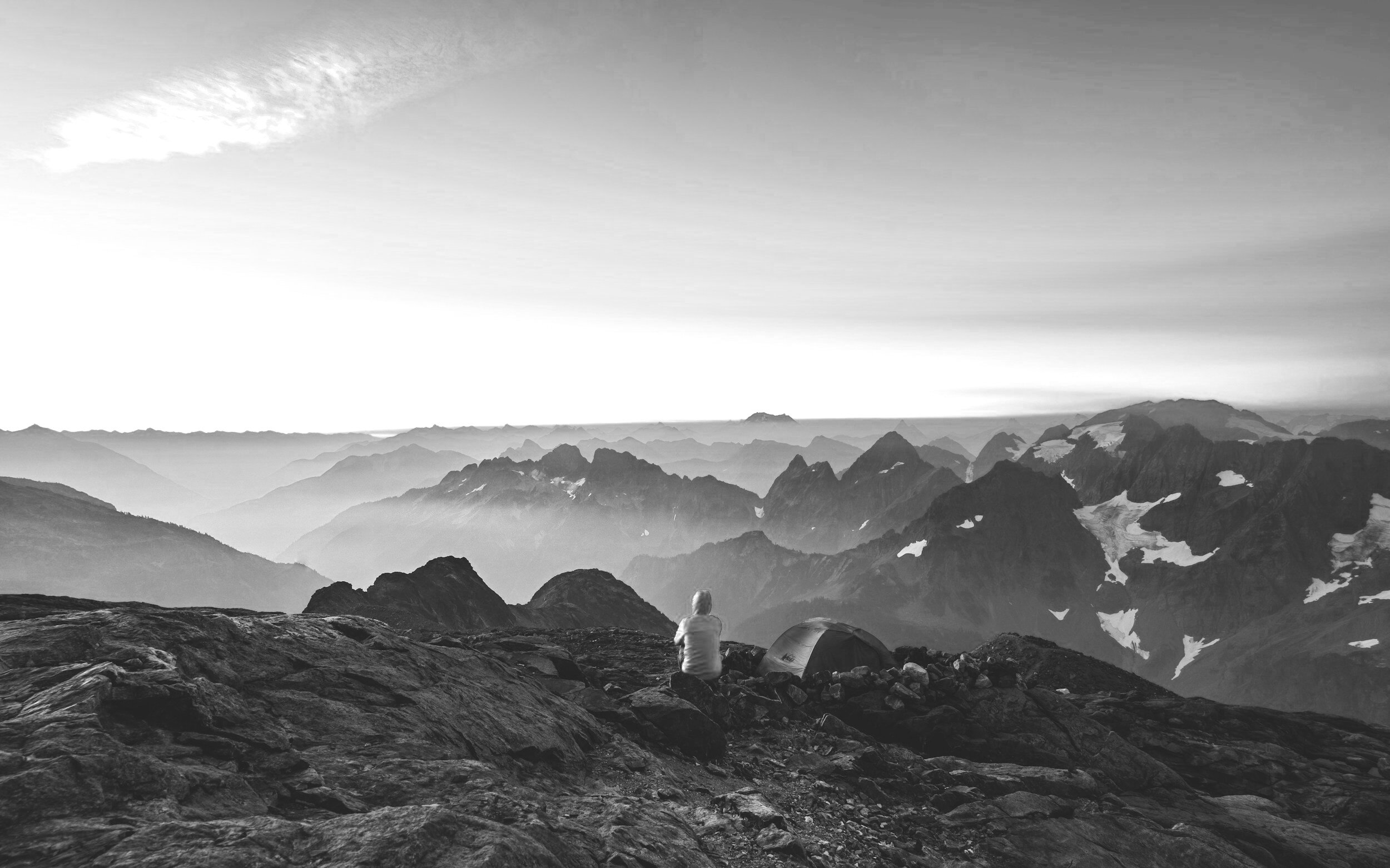
The Climb:
After about 30 minutes of hiking, we are at the base of the climb! Instructions and reminders on gear and its removal, proper hydration, the rope systems, and belaying will be covered. We finish with a partner check, and then the team climbs!
End Of Day Debrief:
At the cars, we focus our attention on the day; sharing the Rose, the Bud, and the Thorn to ruminate more deeply on the experience. It is often customary ( but not mandatory) to have a meal back in the town to celebrate the great days spent in the mountains!
-
The same rock formation that forms the Flatirons is also present along much of the Front Range, including in Fort Collins and Colorado Springs. Rocks similar to the Flatirons exist at both Red Rocks Amphitheater and Roxborough State Park, but they aren’t as tall or as abundant as Boulder’s monoliths. Why, then, did the Flatirons only form behind Boulder? The answer lies in three key geologic events that were necessary to form these fabled rocks, as well as the sequence in which those events occurred.
The first key event in the Flatirons’ formation was the deposition of a thick pile of sand and gravel that forms today’s massive tilted rocks. This deposition occurred 300 million years ago when Boulder was, as it still is, nestled below a mountain range, but one much older—the so-called Ancestral Rockies, which stood in roughly the same location as today’s Front Range.
Powerful rivers draining these ancestral peaks carried sand and gravel to the adjacent plains, where they accumulated in a massive, 1,000-foot-thick pile of sediment that geologists have named the Fountain Formation, in honor of the excellent exposures along Colorado Springs’ Fountain Creek. As you hike amongst the Flatirons today, you can still spot individual layers in this formation, which stretches the length of the Front Range.
Most of these layers are a foot or more thick and consist of white quartz pebbles embedded in a matrix of gritty pink sand. In contrast, some of the Fountain Formation layers are just a few inches thick and consist of either gravel or smooth red sandstone. Still others consist of silt and are readily identified by their maroon color. This diverse stack of layers reflects the rivers’ changing moods during deposition, as do the similar layers that Boulder Creek is depositing today.
In a normal year, Boulder Creek flows high and fast during spring snowmelt and summer thunderstorms. During those periods, the creek is able to transport heavy sand and gravel from the mountains to the plains. Where it exits Boulder Canyon and the current slows, the creek drops the larger gravel particles, which accumulate in layers an inch or two thick.
Downstream, east of town, the current slows even more, causing the water to drop its load of sand here. These “normal year” deposits are analogous to the Fountain Formation’s thin gravel and sand layers.
But some years are anything but normal. During the floods of September 2013, the region’s creeks were in an angry mood, and their swift, powerful flows eroded their banks and carried off any trees, roads or houses standing in their way. As the floodwaters waned, piles of cobbles, pebbles and sand up to several feet thick accumulated in the river channels, while silt and mud blanketed the adjacent floodplains. Similar floods on the ancestral streams deposited the Fountain Formation’s thick sand and gravel layers, as well as the maroon siltstone across the region’s floodplains.
Although the Fountain Formation stretches the length of the Front Range, Boulder is the only locale that hosts dozens of towering flatirons. This is due to a geologic quirk of fate: Here, and only here, the Fountain’s layers are held together by an unusually strong, potassium-rich cement called adularia, which is called moonstone when it’s gem-quality.
This cement only formed near Boulder because on two occasions—about 135 million and 94 million years ago—warm, potassium-enriched water welled up along an ancient fault zone that stretches between Eldorado Springs and Idaho Springs. The Fountain Formation’s grains reacted chemically with that water to form rims of adularia that tightly bind its grains together.
The final event in the Flatirons’ formation was the building of the modern Front Range, which lasted from about 70 to 64 million years ago. The uplift was accomplished along a series of faults whose motion tilted the Fountain Formation layers down to the east, creating the Flatirons’ impressive 50-to-60-degree slopes.
In the process of building today’s peaks, one fault north of Baseline Road shoved rocks from the west up and over rocks to the east. Farther south, a different fault, which cuts right through the Flatirons, shoved layers from the east up and over rocks farther west. Thanks to the eastward tilt of the rock layers, this east-over-west fault geometry stacked up a double thickness of the Fountain Formation on Green Mountain and Bear Peak—a bit of geologic serendipity that, along with the exceptionally strong cement, has made it much more difficult for Mother Nature to quarry and remove the Fountain Formation in this area, resulting in Boulder’s iconic backdrop.


-
FOOTWEAR
+Socks
UPPER LAYERS
+Synthetic T-shirt
For Colder Days Please Consider
BOTTOM LAYERS
GLOVES/HATS
+Buff
BACKPACKS
+15-20L Climbing Backpack
+35-55L Crag Pack
ACCESSORIES
+Sunglasses, Sunscreen, Lip Balm, Sun Hat
+Nalgene, Minimum 1.5L
+Climbing Snacks: 100 calories an hour!
EQUIPMENT
+Belay Device w/Locking Carabiner
+3 Additional Locking Carabiners
+120cm Sewn Sling w/ Non-Locker
+Autoblock Cord w/ Non-Locker
Smile Mountain Guides can supply rock climbing gear including helmets, harnesses, shoes, ropes, cams, slings, carabiners, belay/rappel devices.
PREPARATIONS FOR CLIMBING THE FLATIRONS

Technical Experience
No technical climbing experience is required for this adventure

Fitness
Moderate physical fitness is recommended. Climbers should be able to hike and climb for approximately 6-8 hours while carrying a small pack.
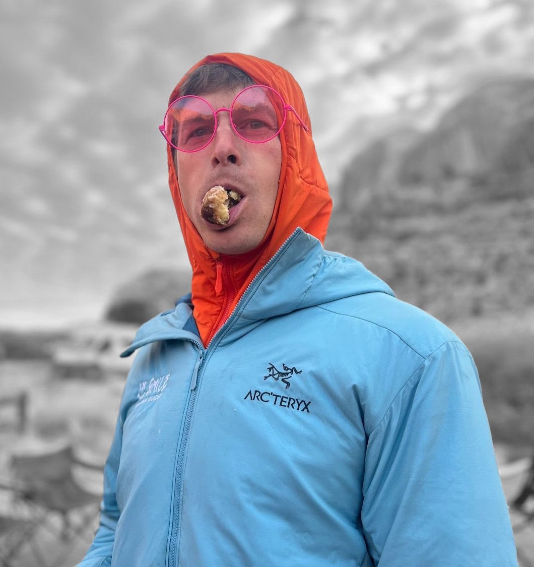
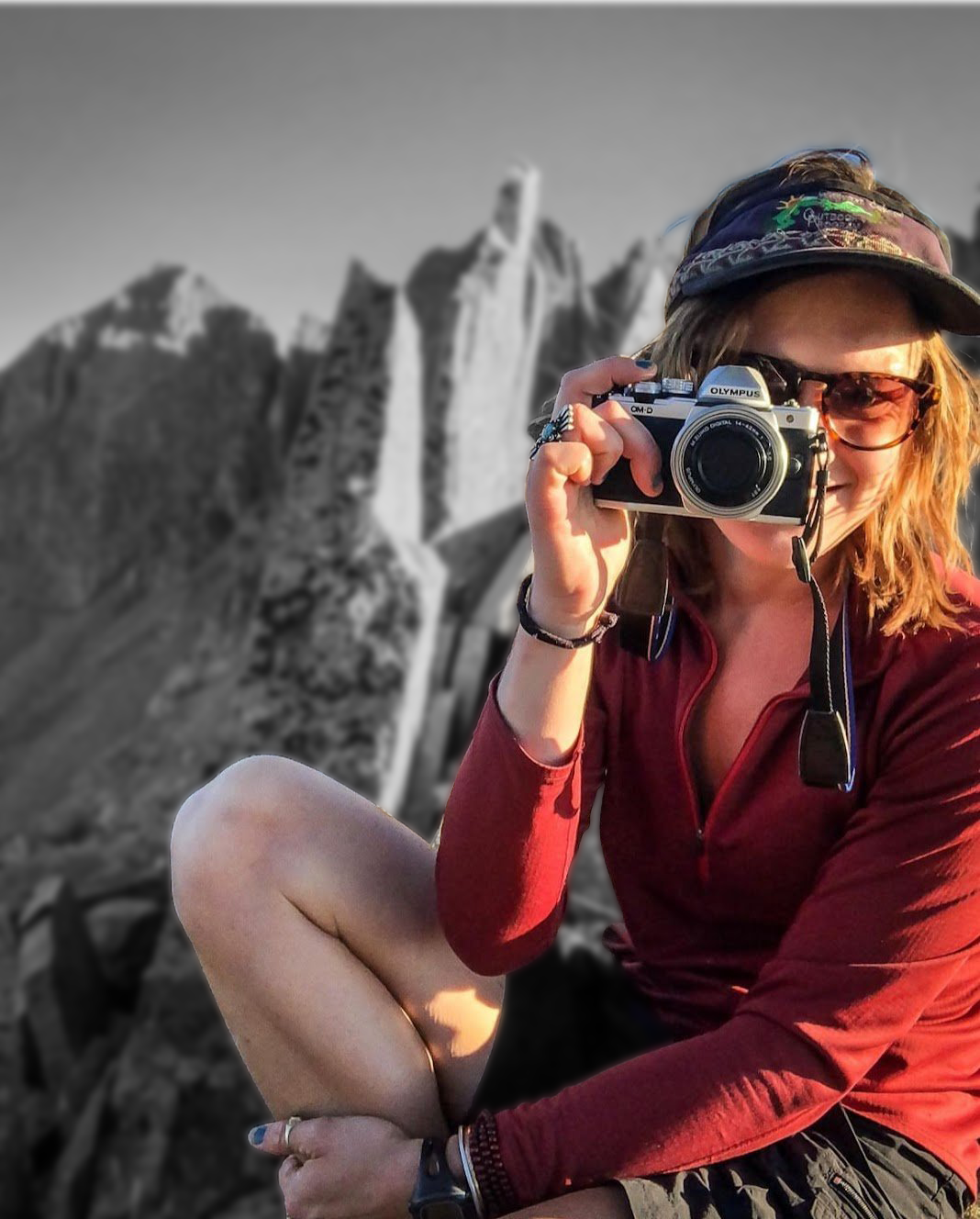
Our Front Range Rock Guides
-
![]()
Meg Nickman
-
![]()
Jeffrey Mascaro
-
![]()
Heidi Wirtz
-
![]()
Brent Smith
-
![]()
Mike O'Connor
-
![]()
Jesse Selwyn
-
![]()
Nathan Schumacher
-
![]()
Jess Worley
-
![]()
Suzanna Lourie


FAQ’s
Climbing the Flatirons
The answers to our most commonly asked questions for The Flatirons.
-
PRICE INCLUDES
+Guide fees (2:1 climber-to-guide ratio)
+Group equipment such as ropes, helmets, harnesses, shoes, and technical climbing equipment.
+Small multi-pitch backpack
PRICE DOES NOT INCLUDE
+Personal equipment (see Gear List)
+Transportation
+Hotels/lodging in Boulder
+All expenses incurred in the event of early departure (evac fees)
+Trip cancellation insurance
-
Smile Mountain Guides provides the following gear.
Technical:
+Helmets
+Harness
+Shoes
+Small backpack
+Ropes and group technical equipment
Smile Mountain Guides does not provide the clothing needed to be comfortable in the mountain environment.
-
Smile focuses on small groups and ratios that meet the professional mountain guiding standard. These programs have a 2:1 ratio. We can accommodate a maximum group size of 10 climbers with 5 guides if the group chooses different climbing routes and on the Flatirons formations.
-
Please click here to review our domestic cancellation policy.
-
Yes! This is a custom adventure!
A large portion of our business is designed around custom adventures. Please email, climb@smilemountainguides.com if you would like more information.